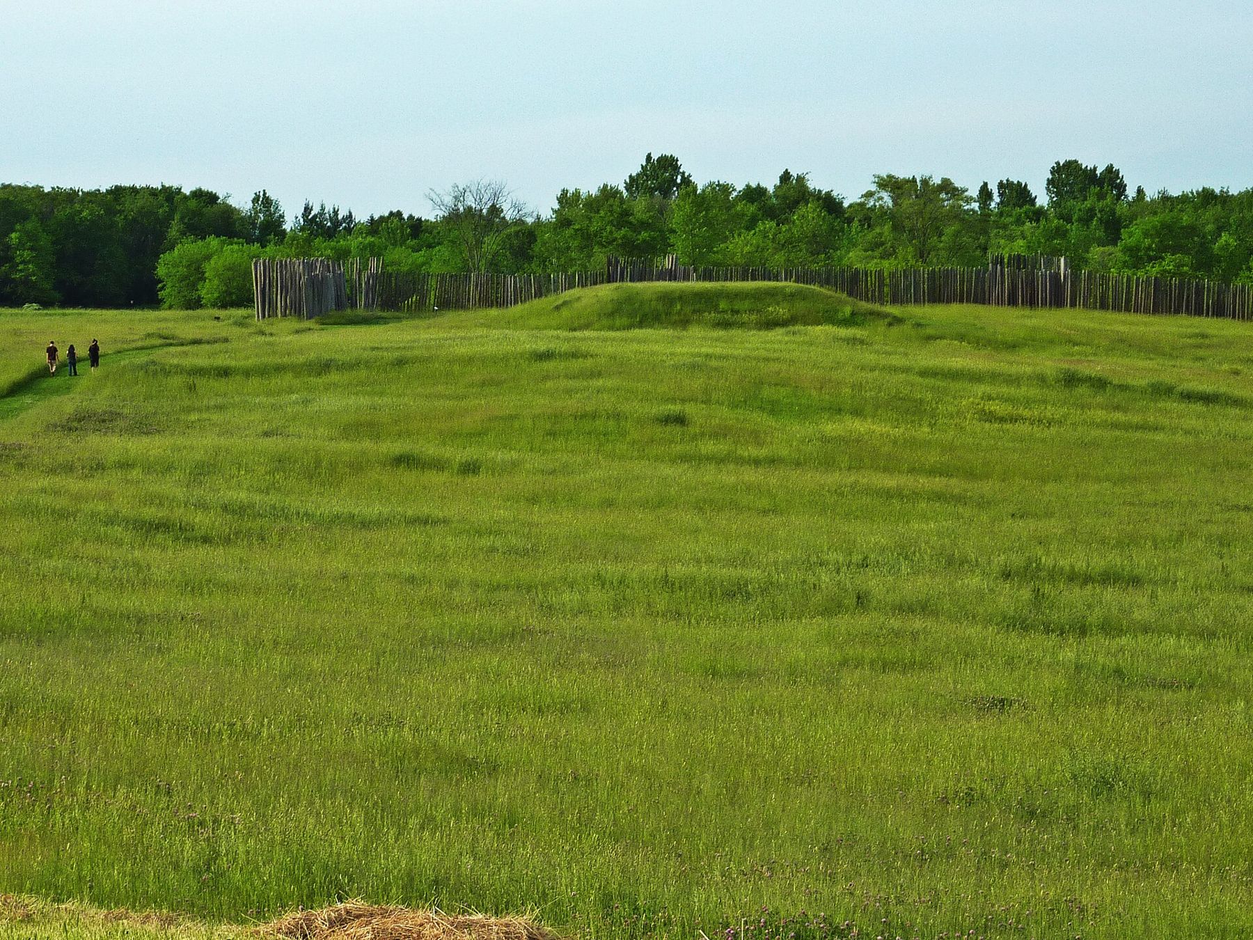
The Crawfish River bends slowly past a low terrace a few miles east of Lake Mills, a short way upstream of where it joins the Rock. On its west bank, grass-covered pyramids rise above a meadow, and a line of tall wooden posts runs along the edge of the field. From the road it looks like a park with odd hills. Walk in, and the layout of a town slowly takes shape: plazas, platforms, a wall, and a river that brought people and goods to it from far to the south.
A town on the river
People lived on this terrace for a long time before the town was built. Late Woodland communities farmed, fished and gathered here, and left their own traces. Then, around 1000 to 1100 AD, something new arrived. People connected to the Mississippian culture, whose great centre was Cahokia near present-day St. Louis, came to the Crawfish River and built a planned settlement alongside or together with the people already here.
Mississippian towns shared a pattern. They had large open plazas, flat-topped earthen platform mounds that held important buildings, and in many places a stockade. Aztalan had all three. It is the northernmost large Mississippian site known, which makes it one of the most significant archaeological places in the upper Midwest.
Mounds, plaza and stockade
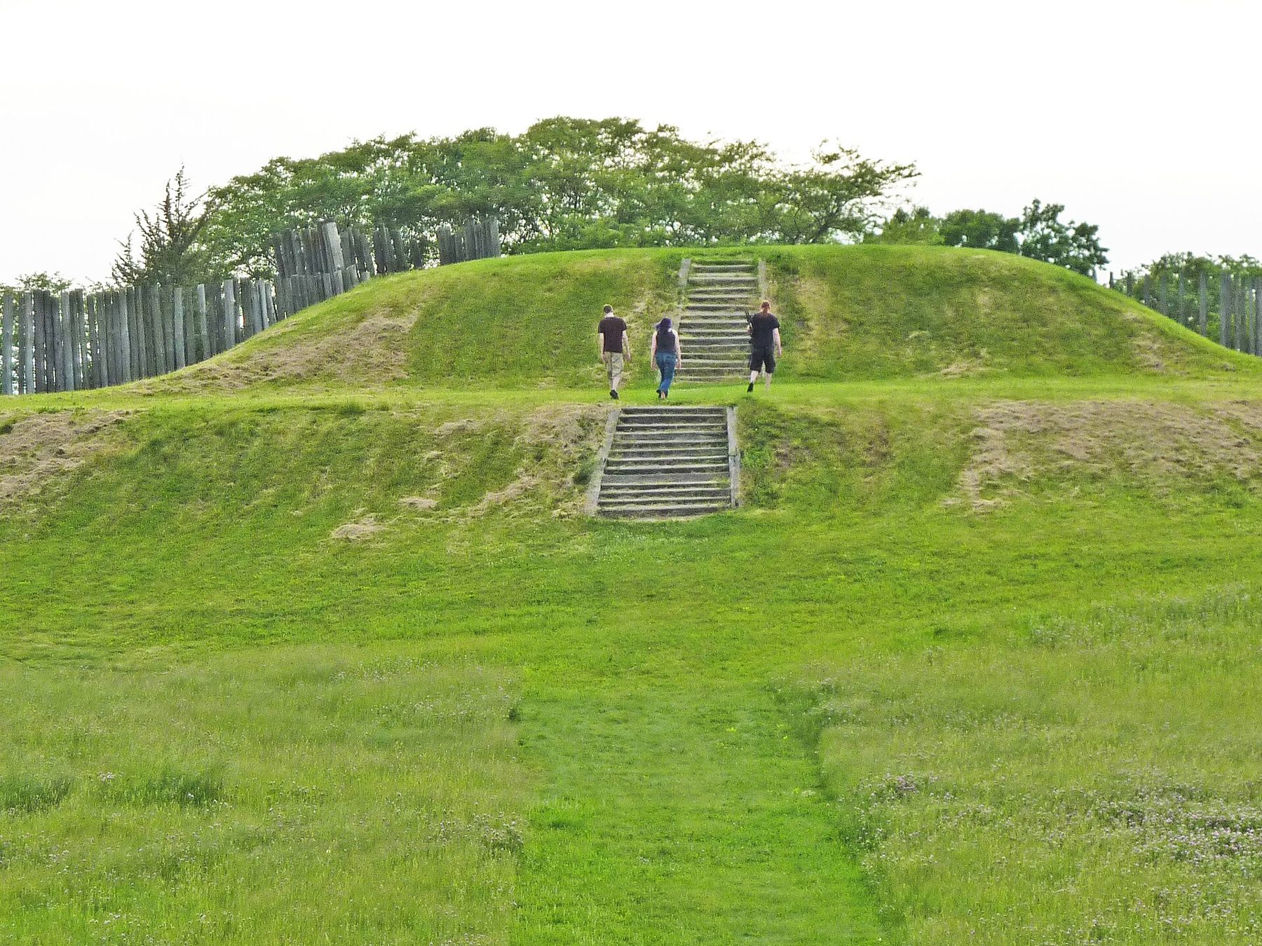
The largest platform mound stands at the southwest corner of the site, built up in stages with a terrace partway up. Another rises in the northwest corner. Buildings once stood on their flat tops. Their exact uses are not fully known, but platform mounds in Mississippian towns generally supported structures for leaders, community ceremony or the dead.
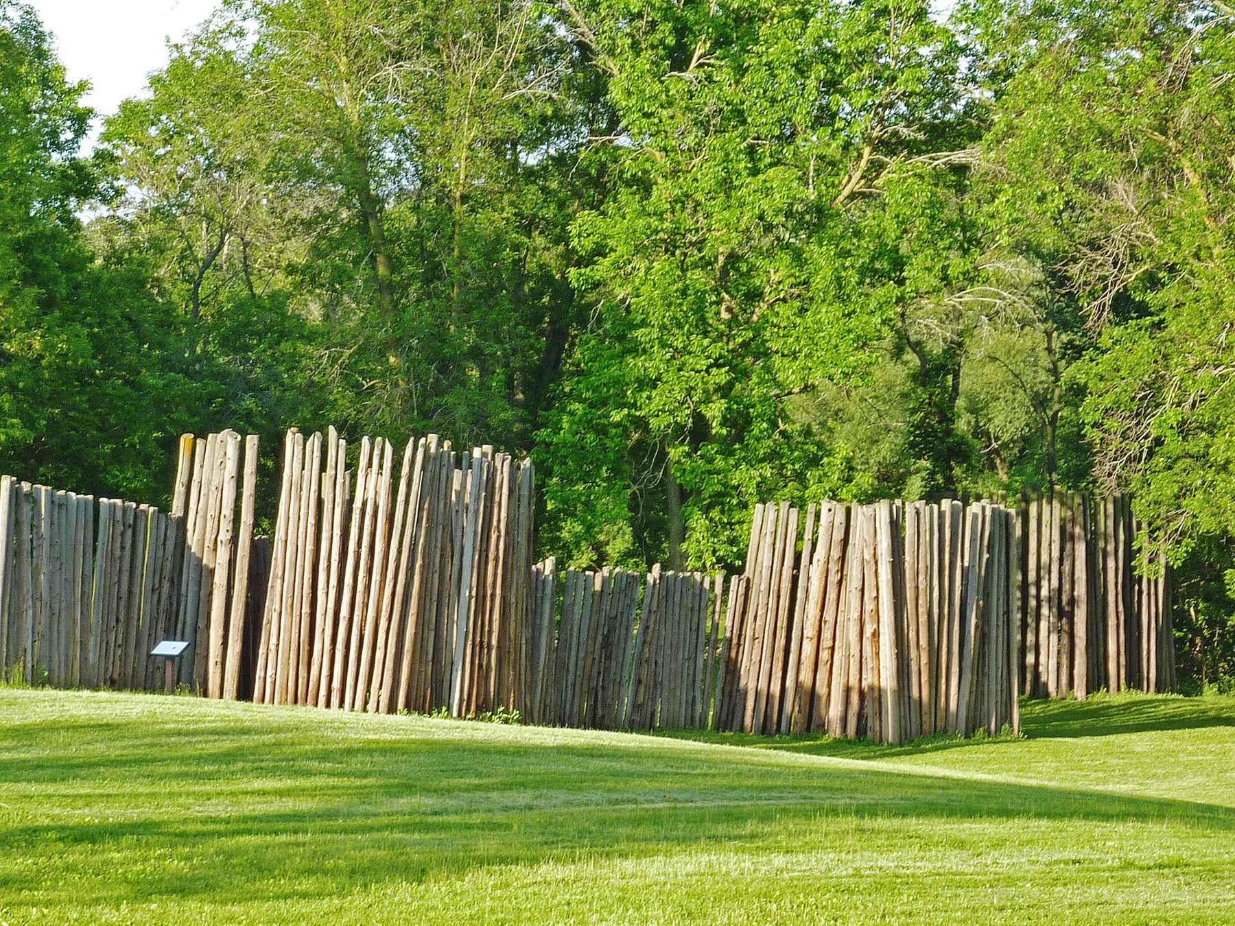
Around the town, and dividing parts of it, ran a palisade of upright logs plastered with clay and grass, with square towers set at intervals along its length. The palisade was rebuilt several times. It enclosed the central plaza, the main mounds and houses, and it ran down toward the river.
The people of Aztalan grew corn, squash and beans in the fields around the town, fished the river and hunted. Pottery, shell and stone found here show trade links reaching well beyond Wisconsin. On a ridge to the northwest stands a line of smaller conical mounds, a separate feature whose purpose is still discussed.
Abandonment and rediscovery
By around 1300 AD the town was empty. Why its people left is not known with certainty, and careful accounts leave the question open. Many Mississippian centres across the Midwest were abandoned in the same period, and changes in climate, politics and population likely played a part.
Euro-American settlers reached the site in the 1830s. One early visitor gave it the name Aztalan, from a belief that the Aztecs had come from a northern land of that name, a theory with no basis in fact that nonetheless stuck. Increase Lapham surveyed and mapped the site in the 1850s, and his drawings remain an important record of how it looked before the plough.
What followed was damage. The mounds were farmed over, dug into by curiosity seekers and stripped for their fired clay, which was carted away to surface roads. Much of what made the site legible was lost before archaeologists began careful excavations in the twentieth century. Those excavations established the layout and age of the town, and the land eventually passed to the state as a park.
Daily life inside the walls
Inside the stockade, people lived in houses of poles covered with woven mats or clay, set close together near the plaza. Food was stored in pits dug into the ground. Hearths, pottery and tools found in excavations point to the ordinary work of a farming town: grinding corn, scraping hides, cooking, making and repairing tools, and preparing for winter.
The plaza was the town's open centre, kept clear and level. Some of it was reshaped and filled to create a flatter surface, a large task in itself. Gatherings, ceremonies and games likely took place there, as they did in other Mississippian towns, though the details at Aztalan are not known.
The river mattered at every level. It supplied fish and mussels, carried canoes to and from the Rock River and beyond, and set the town on a terrace safe from most floods. Standing on the mounds today, you can see how deliberately the builders chose the ground.
A place that still matters
Aztalan is not only an archaeological site. It is a place of significance to Native nations today, including tribes in Wisconsin whose ancestors lived in this region for thousands of years. Burials have been found here, and state law protects the mounds. The rebuilt stockade sections and the reshaped platform mounds were made to help visitors understand the town; the earth beneath them is still the original work of the people who built it.
Wisconsin also holds thousands of older effigy mounds, built in the shapes of birds, bears and water spirits by earlier peoples. They are a different tradition from Aztalan's platform mounds. If you want to follow that thread, read our page on the effigy mounds of southeast Wisconsin.
Seeing what remains today
Drive east from Lake Mills toward the crossroads hamlet of Aztalan and follow the signs to the park entrance on County Q. The park is day use only, with parking near the river and a small picnic area. State park rules on vehicle admission apply; how they are applied here can change, so check before you go.
Walk to the southwest platform mound first. Use the wooden stairs, not the grass slopes, which erode under feet. From the top you can see the whole town plan: the plaza below you, the northwest mound across the field, the line of the rebuilt stockade and the river beyond it.
Then follow the mown paths along the stockade. The upright posts stand where archaeologists found the original post holes, so the line you walk is the town's real edge. Notice how close the town sat to the water, and how much of its life faced the river.
Look for the line of conical mounds on the high ground to the northwest. Stay off them. Leave every stone and shard where it lies; picking up artifacts here is illegal and disrespectful.
Read the signs and panels as you go. They mark the plaza, the positions of the mounds and the line of the original palisade, and they are the best guide to what is original earth and what was rebuilt for visitors.
Come in the morning or near sunset. The low light picks out the terraces of the mounds and the slight rise of the plaza, and you are likely to have the grass to yourself. Spring and autumn are the most comfortable seasons; there is little shade in July.
Before or after, spend an hour in Lake Mills, a lake town of old houses and a square, or follow the river down to the Rock River at Fort Atkinson. You can also reach the area by bicycle on the Glacial Drumlin State Trail, which passes through Lake Mills a few miles to the west.