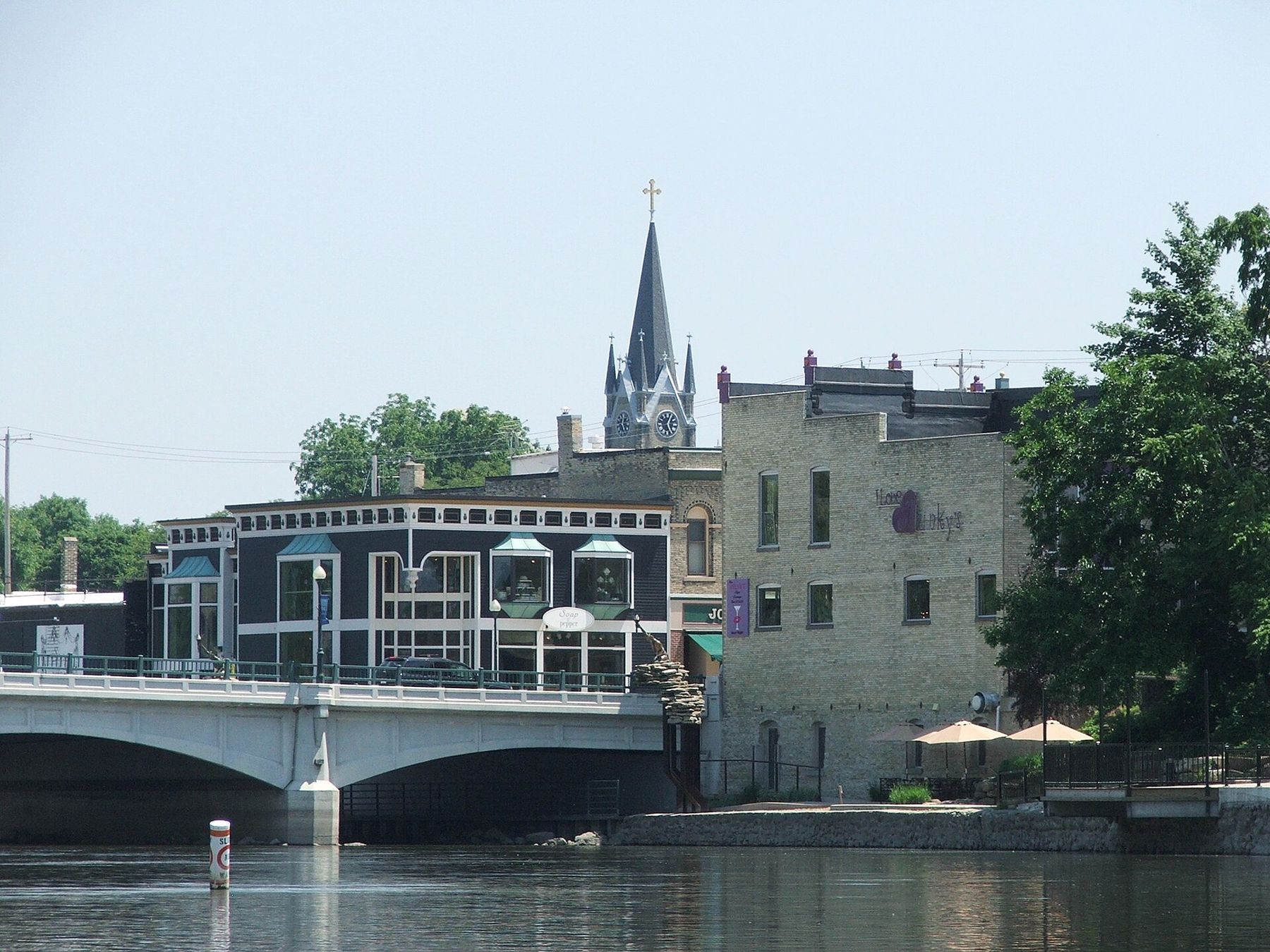
The Rock River runs straight through the middle of Fort Atkinson, wide and slow and brown, and the town faces it. Bridges cross it downtown, a riverwalk follows its banks, and the older commercial blocks back right onto the water. Start at the river and the rest of the town falls into place around it.
Fort Atkinson is a small city in Jefferson County, west of the Kettle Moraine and roughly halfway between Milwaukee and Madison. It takes its name from a stockade built nearby in 1832, during the Black Hawk War, by troops under General Henry Atkinson. The fort itself is long gone. The town that grew up after it became a dairy and manufacturing center, and that history still shows in its museum, its industry and its streets.
How to arrive in Fort Atkinson
From Eagle, take WIS 59 west through Palmyra to Whitewater, then US 12 northwest to Fort Atkinson. It is about 40 minutes of easy two-lane driving through farmland. From Madison, take I-94 east and US 12 or WIS 26 south; under an hour. From Milwaukee, take I-94 west to WIS 26 and drive south through Jefferson, a little over an hour.
WIS 26 and US 12 both bring you close to downtown. Park in the public lots near the river or on the street and walk; the riverwalk, the museum and Main Street are all within a few blocks of each other. There is no passenger rail service.
The riverwalk and downtown
Walk the riverwalk first. It runs along both banks of the Rock through downtown, with benches, plantings and views of the bridges and the old brick backs of Main Street. Go early in the morning in summer, when the light is low over the water and herons work the shallows below the dam.
Then cross into the downtown blocks. Main Street has the usual mix of a working small-city center: cafes, a few independent shops, banks and offices in nineteenth-century buildings. It is not a resort downtown, and it is better for it. Walk it end to end and look at the upper storeys, where most of the original brickwork survives.
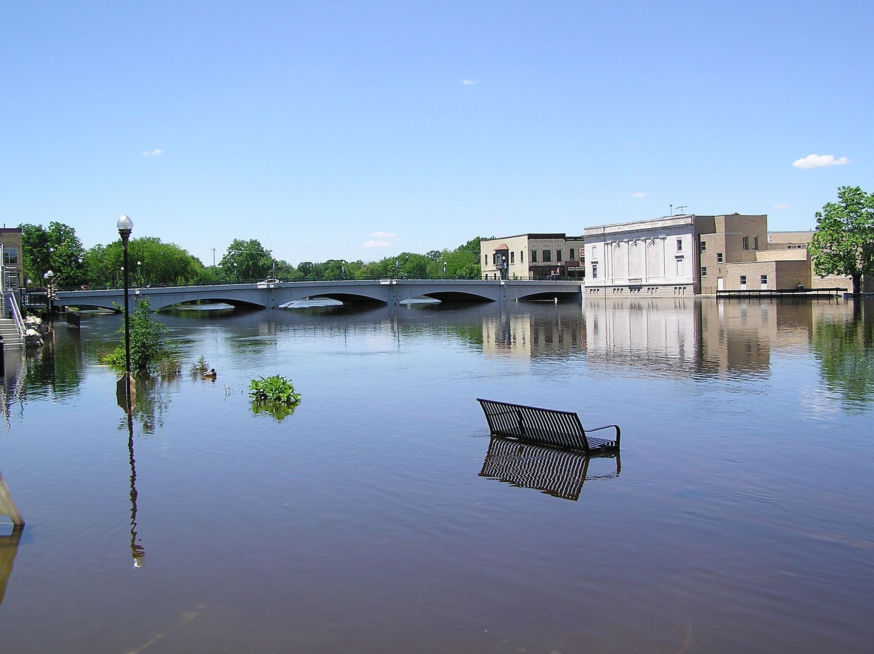
The Rock can rise fast. In wet years it has pushed over the riverwalk and into the low streets near the water, as the photo above shows. If you are visiting in spring, check whether the low paths are open before you plan your walk around them.
Fort Atkinson also has a long music history for a town its size. Small venues have brought touring folk, blues and singer-songwriter acts here for decades. Places come and go, so look at local listings for the week you visit rather than relying on an old recommendation.
The Hoard Historical Museum and the Foster House
Walk a few blocks from the river to the Hoard Historical Museum, in a large old house that belonged to the family of William Dempster Hoard. W. D. Hoard was a newspaperman who became governor of Wisconsin, and his dairy magazine, still published in Fort Atkinson, helped turn the state toward dairy farming in the late 1800s. The museum covers the town's history and the region's dairy past, and it is free to enter, though donations are welcome.
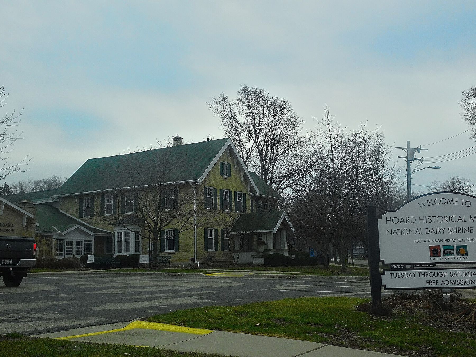
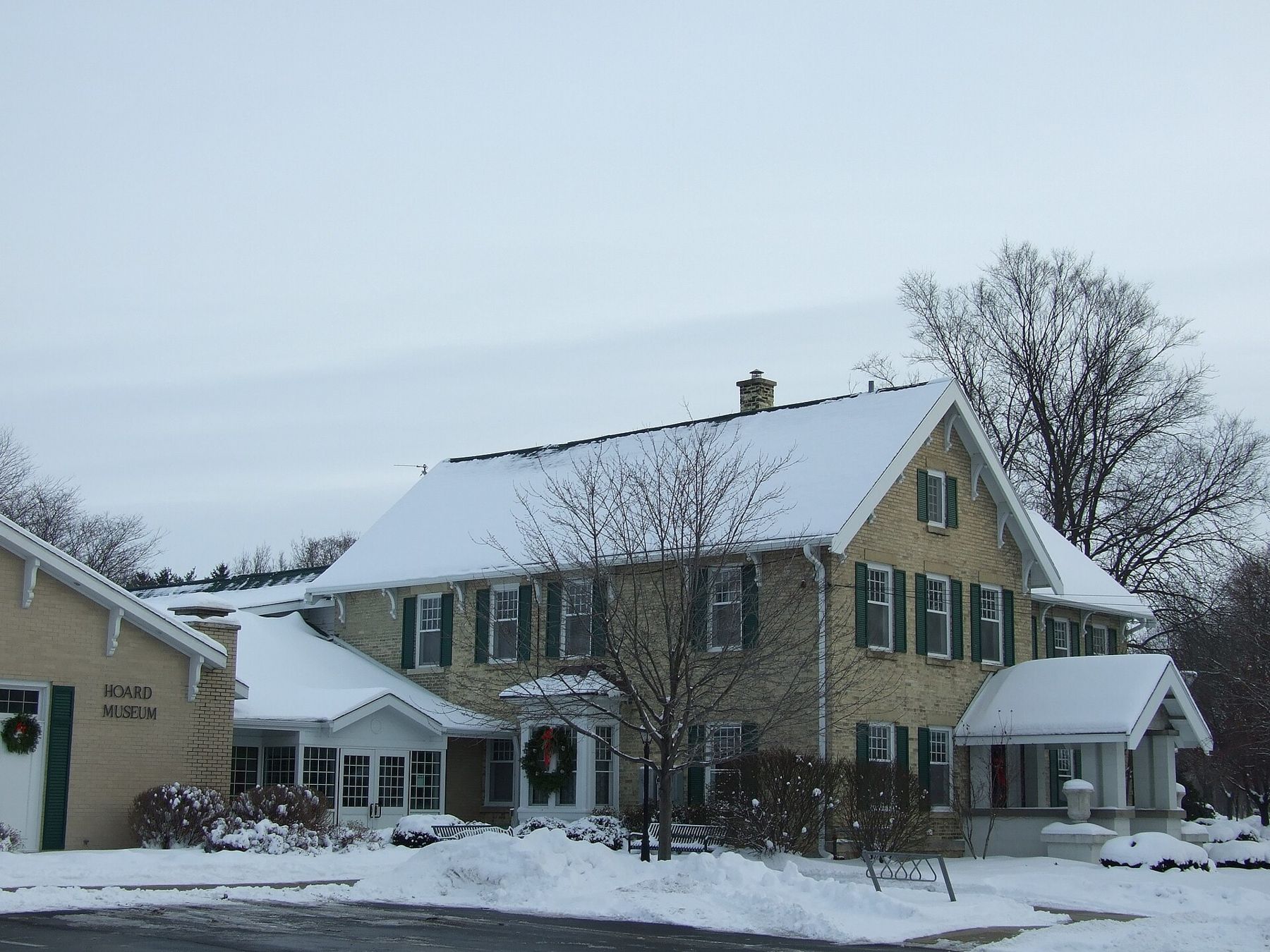
On the same grounds stands the Dwight Foster House, built in 1841 by one of the town's founders. It is one of the oldest houses in the area, and it is furnished to show how a prosperous early settler family lived. Tours of the house run on a limited schedule, so ask at the museum or check before you go. Our page on the Hoard Historical Museum covers both buildings in more detail.
Around Fort Atkinson
West of downtown, along WIS 106, look for the Panther Intaglio. Most effigy mounds in Wisconsin were built up from the ground; this one was dug into it, a long low hollow in the shape of a panther or water spirit. It is the only known surviving intaglio effigy in the state, and it sits on a small piece of protected ground beside a house and the road. Stay on the edge, don't walk in it, and read the marker. Our page on effigy mounds in southeast Wisconsin explains what the shapes mean.
The river is the other draw. South of town the Rock widens into Lake Koshkonong, a big shallow lake popular with anglers and duck hunters. North and east, the river winds through marsh and farmland. Our guide to the Rock River at Fort Atkinson covers paddling and fishing access.
If you bring a canoe or kayak, the stretch of river above the dam is the easier water: wide, slow and good for a gentle paddle past backyards, parkland and marsh. Put in at a public launch, paddle upstream first while you are fresh, and drift back. Stay well clear of the dam itself, and check river levels after rain, when the current picks up and debris comes down.
About 20 minutes north on the county roads, Aztalan State Park preserves the earthworks of a much older town on the Crawfish River. Combine the two for a full day: Aztalan in the morning, when the grass is wet and the site is empty, and Fort Atkinson for lunch, the museum and a walk on the river in the afternoon.
When to go
Late spring and early fall are the best times for a walking visit. The river is up but usually within its banks by late May, the trees along the riverwalk are green, and the museum keeps more regular hours than in winter. In September and October the light is gentle and the air is cool enough for a long walk on both banks.
Summer brings warmer evenings on the river and the town's own events, such as concerts and festivals in the parks; check the local calendar for dates. It also brings mosquitoes near the water at dusk, so carry repellent if you plan to sit by the river after dinner.
Winter is quiet. The river freezes along its edges, the riverwalk is cleared in places but can be icy, and the museum hours shrink. It is a good season for the Panther Intaglio, though: with snow on the ground, the sunken shape stands out clearly against the white.
Give yourself half a day for the town alone, a full day if you add Aztalan or a paddle. The streets are flat and compact, and you will not need the car again until you leave.
Finish where you began. Walk back to the riverwalk in the evening and watch the light go off the water below the bridges.